


استكشاف تشوتن مينديب
أماكن مشهورة يمكنك زيارتها

جامعة بريستول
استكشف الحرم الجامعي في جامعة بريستول كجزء من رحلاتك حول بريستول. اكتشف العروض المسرحية المشهورة ووجهات التسوق في هذه المنطقة الملائمة للتجول مشيًا.

مركز التسوق كابوت سيركس
في أثناء زيارتك بريستول، يمكنك البحث عن تلك الهدية التذكارية المثالية في مركز التسوق كابوت سيركس. جرب الخيارات الترفيهية والحفلات الموسيقية المباشرة في هذه المنطقة الملائمة للتجول مشيًا.
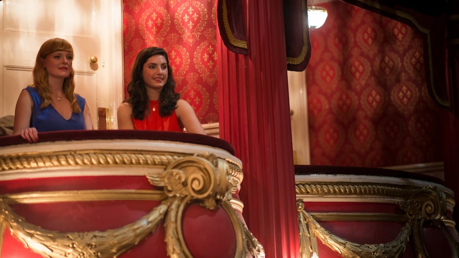
مسرح بريستول هيبودروم
احصل على تذاكر حضور العروض في م�سرح بريستول هيبودروم، والذي يُعد مسرحًا لتقديم القصص في بريستول. اكتشف المتاحف الرائعة ووجهات التسوق في المنطقة.

جسر كايفتون سسبينشن
تعرف على تاريخ بريستول في حال كنت تقضي وقتًا في جسر كايفتون سسبينشن. لا تفوت زيارة وجهات التسوق والمطاعم الرائعة في هذه المنطقة الملائمة للتجول مشيًا.

قلعة ثورنبيري
تعرف على تاريخ تورن بوري في حال كنت تقضي وقتًا في قلعة ثورنبيري. لا تفوت زيارة وجهات التسوق والمطاعم الرائعة في هذه المنطقة الملائمة للتجول مشيًا.

ملعب آشتون جات
استمتع بحضور الفعاليات في ملعب آشتون جات عند قيامك برحلة إلى بريستول.لا تفوت زيارة وجهات التسوق والبارات المُفعمة بالحيوية في هذه المنطقة الملائمة للتجول مشيًا.


